Experience • Community Development
25 Projects Completed
Community Development • GIS Services
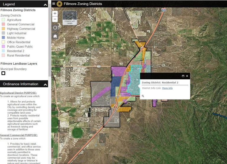
Accessibility of Cloud SMART data is key to those who use it. Quickly search by name or address in a simple online application and understand the value of having this information presented in a manner that is easily interpreted. Cloud SMART GIS can display topographic data, share zoning maps, and host aerial imagery. City governments can conceptualize zoning district changes and link ordinance documentation to those districts in real time. Empower communities with real-world information.