Experience • GIS
10 Projects Completed
GIS • Cemetery Management
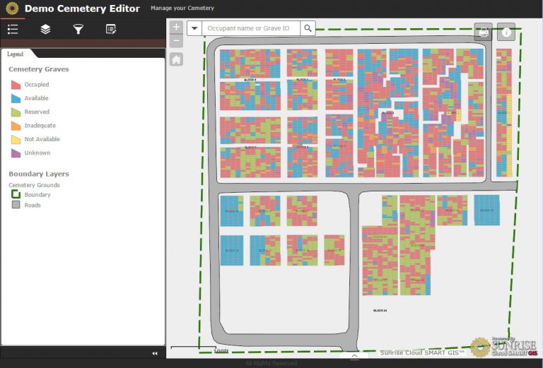
Sunrise Engineering’s SMART GIS combines cemetery records and GIS mapping to greatly enhance cemetery management. SMART GIS not only provides a visual element to view and explore a cemetery, but it can also aid in maintaining them by only allowing certain individuals to update grave availability, costs, and burial information. Our Cemetery Viewer web app allows searching by name, dates, plot owner, veteran status, or by selecting grave sites. All of the data, from burial plots to historical/cultural knowledge about the sites, remains secure on the Cloud SMART server.