When most people think of Geographic Information Systems (GIS), maps are probably the first thing that comes to mind. But GIS technology and the people behind it can do much more than create maps. In recognition of GIS Day this November, we’re highlighting a project that demonstrates how GIS can help solve everyday challenges and what can happen when teams across Sunrise work together.
For Utah Testing and Engineering (UTE), managing equipment across multiple laboratories and field operations had become increasingly challenging. With approximately 700 entries in an Excel spreadsheet, keeping track of equipment locations, assigned personnel, calibration schedules, and maintenance records required significant time and effort.
Carter Rich of UTE recognized that their existing process wasn’t sustainable as they continued to grow. During one inventory review, two employees spent approximately 30–40 hours working through records that were outdated, mislabeled, or missing altogether.
While visiting Sunrise’s Washington office, Carter decided to stop by the Cedar office and talk with Jarom from the GIS team about what might be possible. That conversation sparked a collaborative effort to develop a more efficient, accurate, and expandable equipment management system.
Working closely with Carter Rich, Tim Flinders, and the Utah Testing team, GIS developer Marcus Romboy, with support from Jarom and Mallory, helped bring the solution to life using Esri’s ArcGIS Survey123, Dashboards, Experience Builder, and custom scripting.
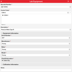
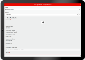
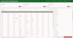
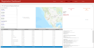
The solution brings equipment registration, tracking, calibration management, and check-in/check-out processes into one centralized application. Employees can scan equipment barcodes, assign equipment to authorized personnel, document transfers between locations, and maintain a record of who has each item and when it was checked in or out.
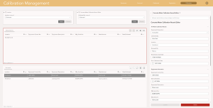
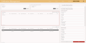
The application also helps manage calibration requirements by identifying equipment that is overdue or approaching its next calibration date, with automated email notifications to help keep the team informed. Equipment photographs provide an additional way to document condition and monitor maintenance needs.
The application also has the potential to strengthen oversight of highly regulated equipment, including nuclear gauges. Future enhancements could help UTE prepare for regulatory audits by tracking equipment locations, documenting interstate transfers, managing required inspections and training records, and providing automated reminders for important compliance deadlines.
By bringing these processes together, the team hopes to reduce administrative work, improve accountability, and make it easier to demonstrate compliance when audits happen.
Throughout development, collaboration has been an important part of the process. Carter credits the GIS team with being responsive, approachable, and willing to make adjustments as UTE identifies additional needs.
What began as a conversation about a difficult spreadsheet has grown into a solution designed to support UTE’s operations today and adapt as their team expands.
This project is a great reminder that GIS is about much more than maps. It’s about finding creative ways to connect information, improve processes, and help people do their jobs more effectively. Sometimes, the next great solution starts with a simple conversation between teams.