Experience • GIS
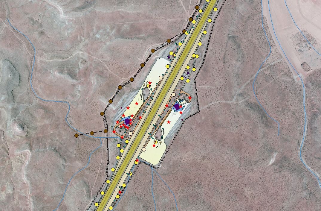
UDOT Ports of Entry
-
Client Utah Department of Transportation
-
Location Statewide throughout Utah
-
Services Database Development
Project Highlights
-
Created a database by combining aerial imagery and on-site collection methods via a GPS unit.
-
Collected and mapped everything owned by UDOT for each location including power poles, light posts, trees, and transformers.
-
Created basemap functionality such as mapping building footprints, pavement, sidewalks, dirt, grass, medians, and other relevant ground areas to be easily distinguished and searchable.
-
Developed a 360-degree virtual management environment (PanoView) that takes the user inside the building and through each room, incorporating actual floor layout design so the user knows exactly which room he or she is in and which way the user is facing.
-
Utilized PanoView to provide UDOT an easy way to assess work orders and maintenance tasks visually from hundreds of miles away.