Experience • 3D Imaging
I-15; SR-73 to 12300 South Widening
-
Client Utah Department of Transportation
-
Location Draper, Utah
-
Services Surface Model, Control Surveys
Project Highlights
-
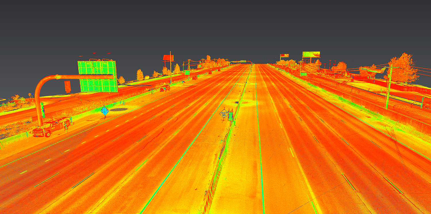
Provided accurate surface model of the paved surface of a 1.5-mile segment of I-15 between 12300 South and Bangerter Highway. The specification required achieving results within ±0.01’ vertical tolerance.
-
Provided horizontal and vertical control points along both frontage roads using digital differential leveling techniques.
-
Collected surface data utilizing the Leica P40 laser scanner.
-
Performed control surveys during daylight hours and scanning at night; no lane closures were required.
-
Met project deadlines and tolerances.